md 0217 concerning severe potential...watch unlikely for eastern oh...western pa...northern wv panhandle
mesoscale discussion 0217
nws storm prediction center norman ok
1140 am cdt fri mar 20 2020
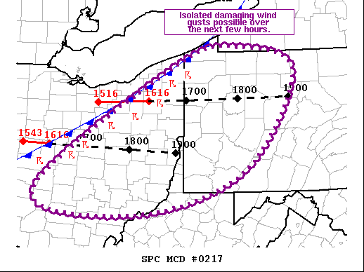
areas affected...eastern oh...western pa...northern wv panhandle
concerning...severe potential...watch unlikely
valid 201640z - 201845z
probability of watch issuance...20 percent
summary...isolated damaging wind gusts are possible across eastern
oh, western pa, and the northern wv panhandle over the next few
hours.
discussion...current surface analysis places the front from far
western lake ontario southwestward into southwest in. gradually
strengthening updrafts have been noted over the past half hour
within the line segments along and just ahead of the front across
oh. this modest increase in storm strength is coincident with minor
increases in low-level moisture and instability. this overall trend
of gradually increasing storm strength is anticipated over the next
hour or two as the storms move across eastern oh and into western
pa. limited instability will likely temper the overall severe threat
(as evidenced by the lack of lightning thus far). however, given the
strong deep-layer shear already in place (supported by 850 mb wind
of 50-60 kt and 500 mb winds from 90-100 kt), strong downdrafts
capable of damaging wind gusts are occasionally possible.
..mosier/thompson.. 03/20/2020
...please see www.spc.noaa.gov for graphic product...
attn...wfo...buf...ctp...pbz...rlx...cle...iln...
lat...lon 41788064 42077934 41667817 40057926 39368146 39698365
41788064
read more